Driving to Key West is the reason a lot of people come to South Florida in the first place. The Overseas Highway, US-1, runs 113 miles from the mainland out to the end of the road, crossing 42 bridges and hopping island to island the whole way. It is a genuinely great drive, but it is not the fast, wide interstate people expect. Most of it is two lanes, traffic bunches up, and there is exactly one road, so a fender-bender ahead of you can turn a 4-hour drive into a 6-hour one. Here is what the drive is like and how to plan it.
How long the drive takes
From Miami, Key West is 3.5 to 4 hours without stops. From Fort Lauderdale add about 40 minutes, and from Orlando you are looking at roughly 7 hours, which is a two-part trip, not a day drive. The reason it is slow is the road itself: two lanes for long stretches, a 45 to 55 mph speed limit through the towns, and no way around a slow RV in front of you until a passing zone opens up. Build in buffer. The map’s estimate assumes a clear road, and the road is rarely fully clear.
| From | Distance | Typical drive time |
|---|---|---|
| Miami | ~160 mi | 3.5 to 4 hrs |
| Fort Lauderdale | ~190 mi | ~4.5 hrs |
| Key Largo | ~100 mi | ~2 hrs |
| Orlando | ~390 mi | ~7 hrs |
The one-road problem
There is no alternate route to Key West. If US-1 closes for a crash or weather, everyone waits. This shapes three decisions. First, leave early, ideally before 9 a.m., to get ahead of the day’s traffic and the afternoon storms. Second, never cut your fuel this fine, because a stall on a bridge with no shoulder is a bad afternoon. Third, watch the forecast in hurricane season (June 1 through November 30), because a mandatory Keys evacuation puts every car on the same two lanes. Most trips see none of this, but plan like the road can surprise you.
Where to fuel and stop
Fill up on the mainland in Florida City before you cross the first bridge, then top off again in Marathon around mile marker 50, because gas gets pricey and stations thin out in the Lower Keys. Good places to stretch your legs on the way down:
- John Pennekamp Coral Reef State Park at MM 102 in Key Largo, for a quick snorkel or a glass-bottom boat if you have time.
- Robbie’s of Islamorada at MM 77.5, where you can feed the tarpon off the dock and grab lunch on the water.
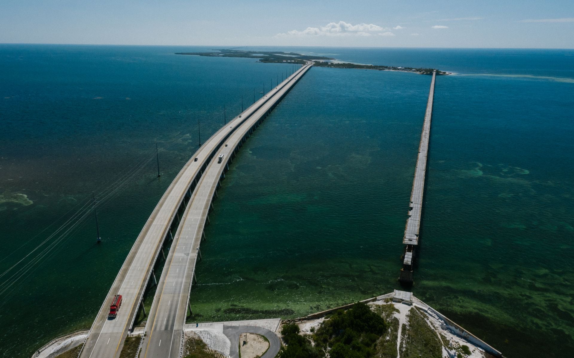
- The Seven Mile Bridge at MM 47, the crossing everyone comes for, with the old bridge running alongside for the view.
- Bahia Honda State Park at MM 37 in the Lower Keys, which has the best natural beach on the drive if you want a swim before the final push.
Traffic patterns to know
The worst backups are around Islamorada, on the approach to Key West, and on Friday and Sunday afternoons when weekenders clog the road. Holiday weekends are worse. If you can drive down midweek and back on an off day, the road opens up a lot. Sunday-afternoon southbound and Sunday-evening northbound are the two windows to avoid if you have any flexibility.
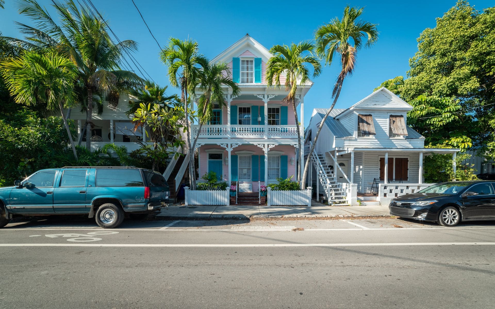
Where to stay when you arrive
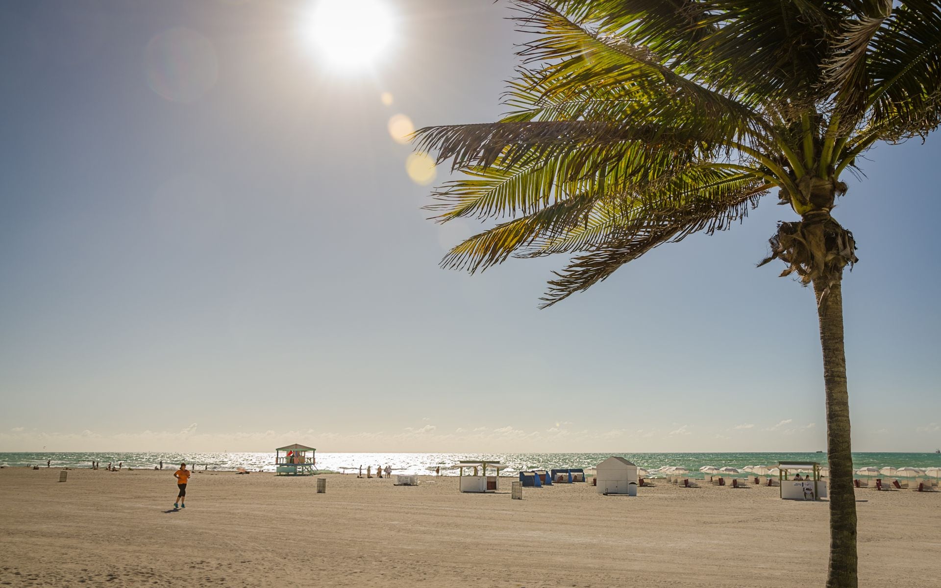
Key West rewards you for staying at least one night rather than turning around. Opal Key Resort & Marina sits at the historic seaport, walking distance from Mallory Square, Duval Street, and the sunset crowd, so you can park the car and not touch it again until you leave. Once you are settled, book the water: Fury Key West Watersports and Sunset Watersports Key West run reef and sunset trips from the harbor, and Danger Charters does a good sail-and-kayak combo. Cool off at Fort Zachary Taylor Historic State Park Beach, the best swimming spot in town. If the Dry Tortugas is on your list, book that ferry weeks ahead in peak season because it sells out.
Is the drive worth it?
Yes, as long as you treat it as part of the trip rather than a transfer to get through. The bridges, the water on both sides, the little island stops, and the slow slide into Key West are the experience. The mistake is trying to do it as a same-day round trip from Miami, which turns a great drive into 8 hours in the car for a few hours at the end. Give it the time. Our Florida Keys road trip guide breaks the whole chain down mile by mile, and the driving the Overseas Highway to Key West page covers the route logistics in detail.
What the drive feels like, section by section
The first hour out of Miami is not scenic. You clear the suburbs of Homestead and Florida City, cross the last of the mainland, and then the road opens onto the first long water crossing into Key Largo. That transition, from strip malls to open turquoise on both sides, is where the trip really starts. Through the Upper Keys the road hugs the islands, with the Atlantic on your left and Florida Bay on your right, close enough that on a calm day the water looks like it is at your window.
The middle of the drive, from Islamorada through Marathon, is the busiest stretch of two-lane, with the most towns, the most turnoffs, and the most brake lights. Then comes the Seven Mile Bridge, the emotional center of the whole run, where for seven straight minutes you are out over open water with the old bridge running beside you. Below the bridge the Lower Keys go quiet and green, and the last hour into Key West is the calmest part of the drive. By the time you hit the “Welcome to Key West” sign you will understand why people say the road is the destination.
Renting a car vs other options
A car is the standard way to do this, and it is the right one if you want to stop. If you would rather not drive, there are shuttle and bus services from Miami and Fort Lauderdale, and some visitors fly into Key West (EYW) directly, though that skips the drive entirely. The strongest case for driving yourself is flexibility: you set the stops, you decide how long to linger at Robbie’s of Islamorada or Bahia Honda, and you are not on anyone’s schedule. Just remember that once you are in Key West itself, you barely need the car. The old town is walkable and bike-friendly, and parking is a paid hassle, so a downtown base like Opal Key Resort & Marina lets you leave it parked.
The Card Sound Road alternative
Most people take the standard route out of Florida City on US-1, but there is a second way onto the island chain that locals use to skip the worst of the mainland backup. Card Sound Road (County Road 905A) branches off east of Florida City, crosses the tolled Card Sound Bridge, and drops you into North Key Largo, where it rejoins US-1 near MM 106. It is a few minutes longer on paper, but when US-1 is jammed on a holiday weekend it can be faster, and it is a prettier, emptier drive through mangrove country. The one landmark worth the stop is Alabama Jack’s, an old over-the-water bar and grill on the way, a genuine slice of old Florida before you hit the tourist stretch. The toll is a couple of dollars and takes SunPass or plate billing, so you do not need cash. If you are driving a rental, check whether it has a toll transponder, because Florida bills unregistered plates by mail with a fee, and the Card Sound Bridge plus the Turnpike on the mainland can add up over a round trip.
Once you are actually on the chain, the driving rhythm changes. You are off the interstate for good, the speed drops into the 45 to 55 mph range through the towns, and the mile markers replace addresses. Reset your expectations here: this is not a stretch to make time on, it is the stretch to enjoy. If you are running the route in reverse and heading back to Miami, the Card Sound option is just as useful for dodging the Sunday-evening northbound crawl through Key Largo and Florida City. Either way, keep an eye on the fuel gauge, because the gap between stations grows the farther south you push. Marathon around MM 50 is your last reliable cluster of full-service gas, food, and pharmacies before the Lower Keys thin out, so treat it as the practical resupply point on the way down and the last easy stop on the way back.
A few money notes
The Keys are not cheap, and driving does not spare you from that. Fuel runs higher the farther south you go, parking in Key West is tight and paid, and hotels command a premium for the location. Budget accordingly and read is Florida expensive to visit for the wider picture. Then check the best time to visit Florida so you drive down in the right season, and start planning from the Florida travel guide.